Super Typhoons and Tech Solutions: Computer Engineering Projects to Save Filipino Lives
Introduction: A Nation Under Siege
The Philippines faces an existential threat. In 2024 alone, six consecutive typhoons battered the archipelago in just 25 days, killing over 160 people, displacing 700,000, and causing nearly half a billion dollars in damage. Super Typhoon Man-Yi brought winds of 195 km/h. Typhoon Kalmaegi left 114 dead and over 100 missing. The climate crisis has supercharged these storms—their potential intensity is now 1.7 times higher than it would have been without global warming.
As Filipino computer engineers, we cannot stand idle while our communities drown. The question isn’t whether technology can help—it’s how quickly we can deploy it. This article examines cutting-edge storm mitigation technologies from typhoon-prone nations like Japan, Taiwan, and flood-expert Netherlands, then proposes concrete computer engineering projects that Filipino developers can implement today.
Learning from the World’s Storm Warriors
Taiwan’s AI Revolution: Predicting the Unpredictable
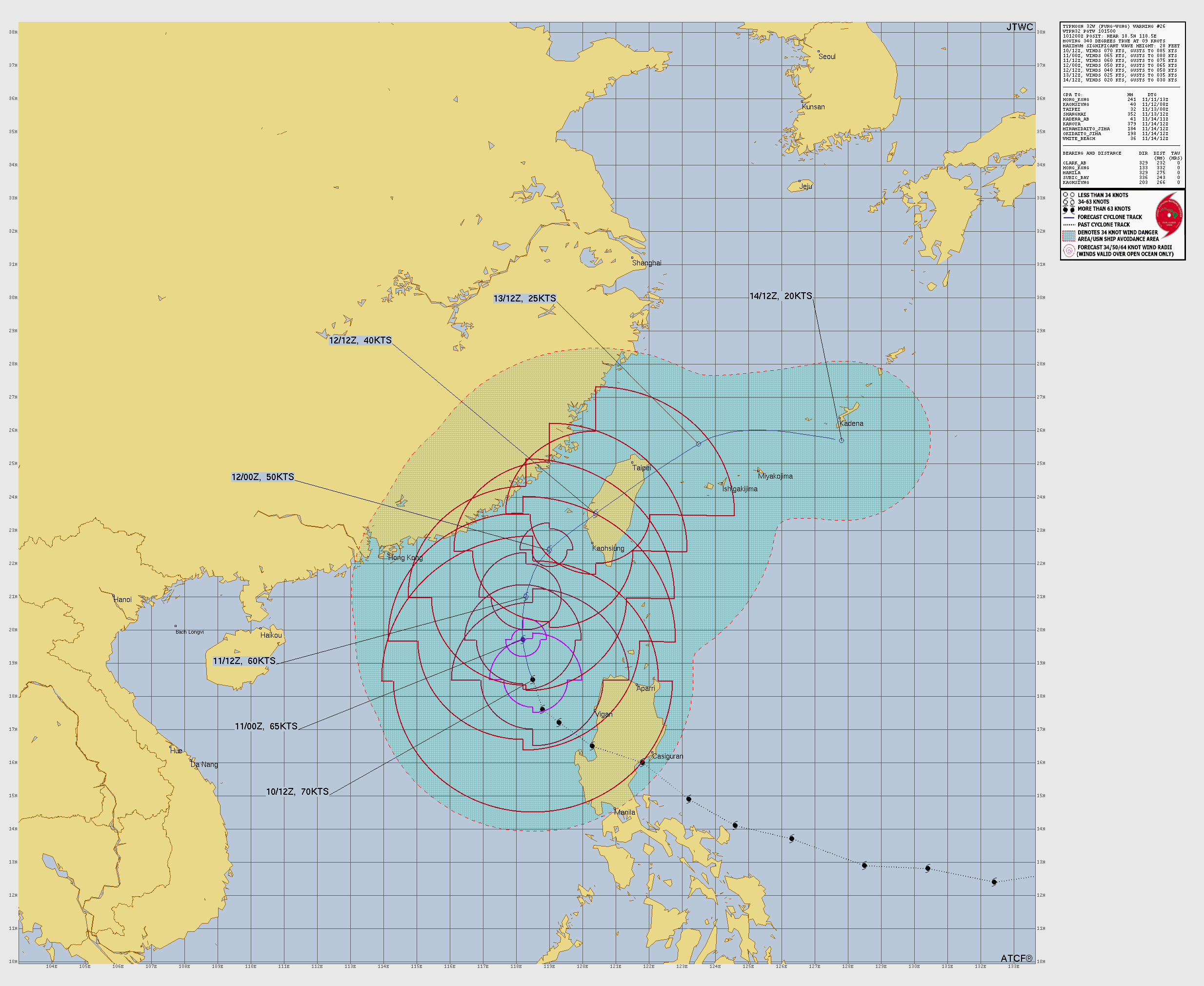
Taiwan has cracked the code on typhoon prediction using artificial intelligence. In July 2024, their AI system predicted Typhoon Gaemi’s direct hit eight days in advance—while conventional models were still uncertain. The results are staggering: AI’s accuracy in predicting storm tracks over three days improved by nearly 20% compared to traditional methods.
Taiwan’s Central Weather Administration deploys multiple AI models simultaneously. Nvidia’s FourCastNet processes weather patterns in minutes instead of hours. Google’s GraphCast successfully predicted Hurricane Lee’s landfall nine days early. Huawei’s Pangu-Weather draws on training from 40 years of historical data. Their partnership with Nvidia on CorrDiff, a generative AI tool, provides high-resolution imaging of storm interiors that conventional satellites cannot match.
The secret? These AI systems learn from decades of historical weather data, identifying patterns invisible to human meteorologists. They can predict hundreds of weather variables simultaneously, accomplishing in minutes what traditional supercomputers take hours to calculate.
Japan’s Sensor Army: 150 Ocean Sentinels
While other nations have four or five ocean monitoring buoys, Japan maintains 150. This vast sensor network feeds real-time data into their Regional Specialized Meteorological Centre, creating an early warning system that saves thousands of lives annually. Each buoy measures wave height, water temperature, atmospheric pressure, wind speed, and ocean currents—painting a complete picture of approaching storms.
Netherlands’ Smart Dikes: When the Sea Fights Back, Fight Smarter
The Netherlands, with 25% of its land below sea level, has pioneered “smart dikes”—flood barriers embedded with IoT sensors that think for themselves. The LiveDijk Eemshaven project streams real-time dike conditions online for public viewing. Their 13,000 kilometers of dikes contain an intricate network of optical fiber sensors that detect microscopic shifts in dike structure, pressure sensors that monitor water infiltration before visible damage occurs, temperature sensors that identify internal erosion through thermal anomalies, and vibrometers that detect structural weaknesses through vibration patterns.
These sensors communicate via Narrowband-IoT, a network designed for underground devices. When anomalies are detected, the system alerts authorities hours or days before visible failure—time enough to evacuate or repair.
Computer Engineering Projects for Philippine Typhoon Mitigation
Based on international best practices and Philippine-specific challenges, here are implementable projects for Filipino computer engineers:
1. BagyoNet: Decentralized Mesh Communication Network
Cellular towers collapse during typhoons, cutting off entire provinces from emergency services. This infrastructure failure costs lives when rescue cannot be coordinated and families cannot communicate. The solution lies in deploying a LoRa-based mesh network that operates independently of cellular infrastructure, creating a resilient communication backbone that survives when traditional systems fail.
The technical implementation uses ESP32 microcontrollers paired with LoRa modules at approximately ₱500 per node. The system implements AODV (Ad hoc On-demand Distance Vector) routing protocol to dynamically find paths between nodes. An Android app connects via Bluetooth to the nearest node, allowing standard smartphones to access the mesh network without specialized hardware. Solar-powered repeater nodes deployed on elevated structures extend coverage across difficult terrain. The system achieves ranges exceeding 30 kilometers in rural areas and maintains 5-kilometer coverage in urban settings despite building interference.
// Sample LoRa Mesh Node Configuration
#include <LoRa.h>
#include <WiFi.h>

const int NODE_ID = 101;
const int SPREADING_FACTOR = 12; // Maximum range
const long FREQUENCY = 433E6; // Philippines ISM band

void setup() {
    LoRa.begin(FREQUENCY);
    LoRa.setSpreadingFactor(SPREADING_FACTOR);
    LoRa.setSignalBandwidth(125E3);
    LoRa.setCodingRate4(8); // Maximum error correction
}
2. KalkulaStorm: Open-Source AI Typhoon Prediction
PAGASA lacks computational resources for advanced AI modeling, leaving the Philippines dependent on foreign weather services for cutting-edge predictions. We can change this by crowdsourcing computing power from Filipino universities and tech companies, creating a distributed supercomputer that rivals any national weather service.
The approach starts by forking Google’s GraphCast, which became open-source in 2023. Training this model on 70 years of PAGASA historical data will tune it specifically for Philippine weather patterns. Processing distribution using Apache Spark across university computer labs turns idle academic infrastructure into a powerful forecasting engine. The inference API deploys on government cloud infrastructure, providing real-time predictions that integrate seamlessly with existing PAGASA warning systems.
3. BantayBaha: Community-Driven Flood Sensor Network
No real-time flood monitoring exists in most barangays, leaving communities blind to rising waters until evacuation becomes impossible. The answer is DIY flood sensors simple enough for high school students to build, cheap enough for every barangay to afford, and robust enough to save lives.
Each sensor uses an ultrasonic HC-SR04 module for water level detection paired with a NodeMCU ESP8266 providing WiFi connectivity for just ₱150. A solar panel charges an 18650 battery, ensuring operation even during power outages. The MQTT protocol transmits data to central servers, with total sensor cost staying under ₱1,000 per unit.
// Arduino code for flood sensor
#include <ESP8266WiFi.h>
#include <PubSubClient.h>

const int trigPin = D1;
const int echoPin = D2;
const int FLOOD_THRESHOLD = 100; // cm

void measureWaterLevel() {
    long duration = pulseIn(echoPin, HIGH);
    int distance = duration * 0.034 / 2;

    if (distance < FLOOD_THRESHOLD) {
        sendFloodAlert(distance);
    }
}
4. SatelayPH: Satellite Imagery Analysis Platform
Limited analysis of free satellite data means disaster preparedness planning relies on outdated maps and guesswork about flood-prone areas. An automated platform processing Sentinel-2 and Landsat imagery can provide daily updates on land use changes, deforestation, and flood risk accumulation.
Google Earth Engine API offers a free tier supporting 10,000 requests daily—more than sufficient for national coverage. Convolutional neural networks trained for flood extent mapping can automatically identify inundated areas from satellite imagery. TensorFlow models assess landslide risk by analyzing slope stability indicators visible in multispectral data. The system generates daily risk maps for all municipalities, pushing notifications to barangay officials via SMS when dangerous conditions develop.
5. EvacuTrack: Real-Time Evacuation Management System
Chaos during evacuations leads to missing persons and resource misallocation. Families lose track of relatives. Evacuation centers overflow while others sit empty. Relief supplies arrive at the wrong locations. A QR code-based tracking system eliminates this chaos through simple, proven technology.
The system generates unique QR codes for each family unit, printable on ordinary paper and laminated for durability. An offline-first Progressive Web App handles registration even without internet connectivity. Data synchronization occurs automatically when connections become available using PouchDB and CouchDB architecture. Real-time dashboards show evacuation center capacity, preventing overcrowding and ensuring efficient resource distribution. SMS integration enables family reunification by matching missing persons reports with evacuation center check-ins.
6. DroneGuard: Autonomous Post-Disaster Assessment
Dangerous and slow manual damage assessment after typhoons delays rescue efforts and reconstruction planning. Roads become impassable. Bridges collapse. Traditional survey teams take days to cover areas drones can map in hours.
DJI Tello EDU drones cost approximately ₱7,000 each and include Python SDK for custom programming. YOLOv5 models trained on disaster imagery automatically detect damaged structures, blocked roads, and stranded populations. Autonomous flight paths using ArduPilot enable systematic area coverage without manual piloting. Edge computing on Raspberry Pi units provides real-time analysis without requiring cloud connectivity. The system generates damage heatmaps that prioritize rescue efforts toward the most affected areas.
7. PinoyPredict: Localized Weather Forecasting
Global weather models lack Philippine microclimate accuracy because they operate at resolutions too coarse to capture valley effects, urban heat islands, and coastal interactions. Hyperlocal forecasting using citizen weather stations fills this gap by providing ground truth data at unprecedented density.
Deploying 1,000 DIY weather stations nationwide creates a sensor mesh five times denser than current PAGASA infrastructure. BME280 sensors measuring pressure, humidity, and temperature cost just ₱200 per unit. The Weather Research and Forecasting (WRF) model runs on modest server hardware when properly optimized. Data assimilation using 3DVAR technique incorporates citizen station readings into forecast models. The result is 1-kilometer resolution forecasts for each barangay, transforming vague regional warnings into actionable local predictions.
Implementation Roadmap for Filipino Developers
Phase 1: Immediate Actions (1-3 months)
Form local developer groups by organizing hackathons focused specifically on disaster technology. Start building prototype sensors with an initial target of 10 flood sensors per participating municipality. Deploy test mesh networks covering one barangay each as proof of concept demonstrations. Create data standards establishing common formats for sensor data sharing across different implementations.
Phase 2: Scale and Integration (3-6 months)
Partner with Local Government Units to integrate systems with existing disaster management infrastructure. Engage university computer science departments through collaboration agreements providing academic credit for student participation. Share all code on GitHub with comprehensive Filipino documentation making the technology accessible to non-English speakers. Apply for DOST-PCIEERD grants providing up to ₱5 million in funding for proven disaster technology projects.
Phase 3: National Deployment (6-12 months)
Establish manufacturing partnerships for local production of sensor hardware, reducing costs and import dependencies. Secure PAGASA integration for official adoption of community-collected data into national forecasting systems. Launch training programs teaching barangay officials system maintenance and troubleshooting. Implement continuous improvement cycles incorporating regular updates based on field feedback and operational experience.
Critical Success Factors
Technology Considerations
Systems must embrace offline-first design principles, working without internet connectivity since typhoons destroy communication infrastructure. Assume unreliable electricity by incorporating low power requirements and battery backup into every component. All hardware needs extreme weather hardening with IP67 rating minimum to survive the conditions they’re measuring. Simple maintenance becomes critical—every component must use replaceable parts available locally rather than requiring imported specialized equipment. Multi-language support spanning Filipino, English, and regional languages ensures accessibility across the entire archipelago.
Community Engagement
Identify barangay champions among tech-savvy locals who can handle maintenance and training. Include disaster technology in STEM curriculum so the next generation grows up understanding these systems. Conduct regular drills with monthly testing of communication systems keeping skills sharp and equipment functional. Establish feedback loops enabling continuous improvement based on user input rather than top-down design assumptions.
Sustainability
Build sensors using Filipino-made components wherever possible, creating jobs and reducing import costs. Explore revenue models selling anonymized data analytics to insurance companies for actuarial modeling. Secure government support mandating integration of disaster sensing infrastructure in building codes for new construction. Develop international partnerships sharing data with global climate researchers, positioning the Philippines as a leader in disaster resilience technology.
Call to Action: Code for Survival
The climate crisis won’t wait for perfect solutions. Every day without action means more Filipino lives at risk. As computer engineers, we have the skills to build resilience into our communities. The technologies exist. The knowledge is available. What we need is the will to act.
Start small. Build one sensor. Connect one barangay. Save one life. Then scale.
Join the movement through our GitHub repository at github.com/ph-disaster-tech where all code will be made available. Connect with fellow developers in the Filipino Developers for Disaster Resilience Facebook group. Coordinate real-time development efforts on our Discord server at discord.gg/phdisastertech. Stay informed through the email list at [email protected].
The next super typhoon is forming somewhere over the Pacific right now. By the time it reaches our shores, we can either be victims of circumstance or architects of resilience. The choice—and the code—is in our hands.
Technical Resources and References
Open Source Projects
GraphCast provides state-of-the-art weather forecasting at github.com/google-deepmind/graphcast. Meshtastic offers production-ready LoRa mesh networking at meshtastic.org. OpenWeatherMap API delivers free weather data integration at openweathermap.org/api. MQTT broker software Mosquitto enables IoT communication at mosquitto.org. TensorFlow Weather extends machine learning to meteorological applications at tensorflow.org/weather.
Hardware Suppliers (Philippines)
E-Gizmo supplies local Arduino components at e-gizmo.net. Circuit.rocks provides ESP32 and LoRa modules at circuit.rocks. Alexan offers sensors and components at alexan.com.ph. RS Components delivers professional-grade hardware at rs-online.com/ph.
Funding Opportunities
DOST-PCIEERD provides grants up to ₱5 million for disaster technology projects. Ideaspace Foundation runs startup incubation programs supporting early-stage ventures. World Bank Innovation Fund finances climate resilience projects across developing nations. Google.org Impact Challenge awards annual grants for technology serving social good.
Together, we can transform the Philippines from a nation that endures disasters to one that anticipates and overcomes them. The storm is coming. Let’s be ready.